Unfortunately, you may see ads on this blog. They appear because I’m on the “free” plan with WordPress. I’ve looked into switching platforms so my followers aren’t bombarded with obnoxious ads, but I haven’t found a good alternative.
I apologize for the fact that you must look at ads on this blog. I have no control over their content and I receive no payments from their existence on my page. Thank you for understanding.
One Thursday in mid-November, Dad and I spend our day driving north into Oregon. We reach Cascade Lakes Highway shortly before sunset. A large sign warns us that the highway will close for the season on Monday at 5am.
At Elk Lake, I turn left onto the dirt road that will take us to the trailhead. Trailhead signs are all covered in black plastic. We pitch our tents near the outhouse, which is unlocked and stocked with toilet paper, for the snowmobilers who will soon be here, I assume. The ground is frosty and already frozen.
Day 1
23.5 miles on PCT (1952.6 to 1976.1), plus 1 mile on access trail
I wake in the dark before my alarm. My tent fly is frosty. My sleeping bag is wet with condensation. While I eat breakfast, I run the heater in my car to dry my sleeping bag and tent fly. By the time it’s light enough to hike, my things are dry and packed. Dad walks with me to the trail and takes a picture of me making a pose similar to the one I made when I left the trail last summer.
Left: leaving the fire closure in 2017. Right: returning to claim my missing miles in 2018.
Then I’m off. I take the left fork; I want to rejoin the trail where I left off last summer. I walk as fast as I can because I’m cold and I need to crank up my body heat. After a mile, I reach the PCT. South Sister lights up in the sun’s first rays. I turn north.
The trail takes me uphill. Occasionally South Sister appears through the trees. I go downhill. Snow patches appear on the north-facing slope. Suddenly the trail is covered in snow. I reach Sisters Mirror Lake. It’s iced over. I feel pangs of doubt. How cold is it going to get tonight? How much snow is out here?
I convince myself that I’m going to be fine. I have all of today, all of tomorrow, and half of Sunday to complete this stretch. I can hike until I encounter something dangerous and still have enough time to turn around and get out.
At least two people have walked here since the last snowfall. Their footprints lead the way over the snowy stretches. I soon realize that I don’t have to check my location nearly so often; these footprints reliably follow the PCT.
I climb and descend a few times. At mile 1960, I reach a frosty meadow. Two of the Sisters tower above the far end of the meadow.
After the meadow, I descend to a frozen stream. The ice isn’t solid enough to hold my weight, so I find a place where I can get across on a small log and a rock.
I pass through the burn that prevented me from hiking this section last year. When I stop to pee, I find a large piece of obsidian.
After awhile I’m out of the forest and back into views. There’s a lot of snow, but there’s still footprints to follow. I’m able to go much faster than I would if these prints weren’t here, showing me the way. The snow slows me down, but not much. It’s solid enough that I’m not slipping or breaking through excessively.
I eat lunch on a boulder in the sun and take off my shoes and socks and let my feet dry.
After lunch, the views of Sisters get better and better. I top out on a ridge where two of the three are lined up before me. I spent awhile trying to take the perfect picture. Then the views get even better: to the north, Mount Washington, Three Fingered Jack, and Mount Jefferson peak over the horizon. I love this stretch of trail!
Two Sisters
I enter the Obsidian Limited Entry Area. I expected to see obsidian here, obviously, but I’m not prepared for how it completely covers the ground. I’ve never seen anything like this. I pass the falls, which are still flowing, and fill up on water at the creek just upstream.
After this, there’s a lot of snow on the north-facing descent. There’s also a view of Mount Washington and Three Fingered Jack, which I savor as I go down snow-covered switchbacks.
I’ve walked over 20 miles by now. I’m a bit concerned about where I’m going to end up. There are several sites listed in Guthooks, but I can’t tell from the topo map if they’ll be snow covered or not. South-facing doesn’t necessarily mean snow-free.
I reach the bottom of the descent and immediately begin another climb. My first potential campsite will be halfway up this climb. On my way up, I reach a lava field. The views open specularly. My potential campsite is in a canyon backed up against a north-facing slope. The ground is frozen. The frost here didn’t even melt today. This place is too cold for me.
Though the sun is low, I keep going. I’m climbing now to the highest point on this hike. I switchback up through lava rock. The moon rises over North Sister. Lava rocks glow red as the sun sinks. At the top of the steep climb, I can again see Washington, Jack, Jefferson, and Hood lined up to the north. It’s one of my favorite views on the whole PCT.
Washington, Jack, Jefferson, Hood
I begin the descent and encounter an icy snowbank across the trail. I deem spikes necessary here so I don’t slip and slide somewhere I don’t want to go. On the far side, I remove my spikes and walk as fast as I can. Darkness is coming.
I find a campsite above the trail where most of the snow has melted. It’s on a knoll, so cold air will sink elsewhere. It’s almost warm up here. Relatively, of course. I can’t decide where to put my tent. The place I want is in range of a dead tree. The snag is sturdy, but I can’t make myself chance it. I pitch my tent as far under a copse of hemlock trees as I can, in hopes that the canopy will help insulate my tent enough to keep me comfortable through the long night to come.
Later, when I get up to pee, I realize I put my tent under another dead tree, one I didn’t see before, one that’s even more rotten than the one I avoided. Great. At least it’s a calm night.
That all changes a few hours later. I’m nearly asleep and suddenly there’s wind. This isn’t just a breeze that comes at nightfall. This is wind. I don’t feel safe sleeping beneath a rotten snag. In the dark, I drag my tent across the campsite into a safer place, one I avoided earlier because I didn’t want to put my tent out in the open with no insulation from trees overhead.
The wind keeps up. Awhile later, I get up to pee again. It’s snowing.
I go back into my tent and try to calm myself down. I have reception here, so I take advantage of it and refresh the forecast. Partly cloudy tonight. Sunny tomorrow. Ok. But it’s snowing.
I think through all of the worst case scenarios. In each of them, I can get out of here safely. I might be miserable, but I’ll be fine. I have the gear for this. I’ll be fine.
I manage to sleep in two-hour shifts. When I’m awake, I hear the patter of small, soft things hitting my tent. I don’t know if it’s hemlock leaves or snow. I’ll find out in the morning.
Day 2
7.6 miles on PCT (1976.1 to 1983.7), plus 6.5 miles on Hwy 242
I wake well before my alarm. I lie in my sleeping bag in the dark, with the wind still blowing and snow still falling. I don’t want to pack up in the dark. Not in this wind. Not in this cold. So I wait.
There’s a dusting of snow all over everything. My tent fly is frozen solid. The snow finally stops. Now it’s just windy.
At 5:45, I start to pack up. My tent is the last thing to pack, so I get out and fight the wind. I’m wearing two pairs of long underwear, my soft shell pants, a hooded fleece top, a micro puff top, and my rain jacket. I’ve never hiked in so many layers before.
As I hike away, I’m warm enough. The wind, however, bestows upon me a wind chill unlike any I’ve ever experienced. When I stop to get something out of my pack, I check my thermometer. It’s 24 degrees. With wind chill…low teens. At most.
When I get out on the bare slopes beside Yapoah Crater, the wind chill takes the temperature lower still. Single digits, I’m sure. There are a few hemlock trees here, and they’re frozen solid. The scenery is dramatic, even more so under ice and a fresh dusting of snow. I take pictures, but I can’t linger. The wind is strong and so, so cold.
My water tube has frozen in its insulator. The water in my Nalgene is icy inside its insulator. Single digit temperatures, for sure. If I’d known it would be this cold, I’d have used a different water strategy. I stuff my water bladder (and its insulator) inside my jacket. After ten minutes, I can get a sip of water. After 20 minutes, I can drink easily again.
I hike for miles with my water inside my jacket. I’m hiking in three layers of bottoms and three layers of tops and I’m not overheating. I’m not cold, either, which is fantastic.
I go through another burned area. I’m significantly lower in elevation now, but even here it snowed last night. The ground is frosted white.
Finally, a mile or so from the highway, I’m warm enough to take off my rain jacket, which has been serving as my wind breaker. I also put my water bladder back into my pack. After this, I enter the lava fields. I fell in love with this lava field last year, so I’m feeling nostalgic as I make way over the icy rocks.
Dee Wright Observatory appears. I’m getting close to the highway. Soon, I can see highway signs peeking above the rocks. The trail takes its time getting there, though.
Dee Wright Observatory
Eventually I wind down and come around a bend and see the highway. This is it. I’ve finished Oregon.
I cross the highway to complete my footpath. I walk to the little wooden PCT sign and take my picture there. The lava stretches on to the north, into clouds.
I walk up to the observatory parking lot. The path to the observatory itself is coated in black ice. Since I don’t want to hurt myself today, I decide not to go up. I take pictures and proceed eastward on the highway. A week ago, McKenzie Highway closed for the winter. It’s a 6.5-mile walk to the eastern snow gate where I’ll meet my dad.
The highway is icy in places, so I mostly walk on the shoulder. A few miles in, two cyclists pass me on their way up. They let me know that my dad is walking up to meet me.
A mile or so later, I round a bend and see my dad on the road. We hug. He gives me the contents of the little box that arrived at my house a month ago, which I hadn’t opened until now. Inside is my PCT finisher’s medal. I ordered it after completing Ebbetts to Sonora back in September. With that hike, I completed the 2017 PCT.
I’m now 52 miles short of a continuous footpath from Mexico to Canada. I’ve walked through all of California and all of Oregon, and all but 52 miles of Washington. This is as far as I’ll get in 2018.
On a Thursday afternoon in mid-October, my friend Evan trail angels me to my second fire closure, the one that (unexpectedly) ended my hike last year, the one I’ve held a grudge against ever since: Seiad Valley to Ashland. Here I come.
We leave my car at the trailhead by I-5, where my mom dropped me off after I recovered from my stomach bug. Then we make the long drive to Seiad Valley.
I start hiking at 5:20pm carrying 7.5 liters of water for 30 dry miles. This will be the longest dry stretch I’ve ever tackled. If I’m lucky, at least one of the seasonal springs along the way will be trickling. But with no recent updates to the water report, I can’t count on that, thus the 16+ pounds of water in my pack.
The climb out of Seiad Valley is one of the most notorious on the PCT: long, steep, hot, dry. The trail starts off even steeper than I remember. Gnats swarm my face. Mosquitoes, too. Almost a mile in, I pass the site where I camped with Dad, where I ended my hike last October. Shortly after that, I come to a piped spring. It’s flowing! I don’t need water yet, but I take this as a good sign of what’s to come.
I reach my intended campsite 1.7 miles and 1,100 feet into the climb. To my immense relief, there are no dead trees overhead. There are, however, an abundance of insects to swarm my face.
I pitch my tent and toss my things inside. In I go, escaping the gnat cloud. Inside my tent, I hear the river and the highway below. Occasionally, there’s an animal call just uphill. The first time, it sounds like a coyote. The second time, I suspect a bird, probably an owl. A juvenile Great Horned Owl making odd whistlely whiny noises? A Northern Pygmy Owl? I feel defeated by this call I can’t ID. There’s also a lot of crickets.
Darkness comes early. I’ll be in my tent for the next 12 hours.
Day 2: The notorious climb
20.9 miles (1658.4 to 1679.3)
I wake in the dark before my alarm. I can’t fall back to sleep, so I pack up and hike away by the light of my headlamp.
Seiad Valley and Klamath River
I climb and climb. Sometimes the trail is well-graded. Sometimes it’s really steep. I lug 7 liters of water up the 4,000-foot climb, stopping once to sit on a boulder and rest. After a few hours, I reach the top. I go along a ridge from which I can see Shasta – and brown smoke on all horizons. The surrounding mountains look spectacular from up here, though. Now that it’s over, the climb doesn’t seem all that difficult, after all.
The trail undulates down, then up. I reach a fork and drop onto the eastern side of the mountain. On the descent, I meet a southbound hiker. His name is Tinker. He’ll soon finish his thru hike at Castle Crags. I congratulate him.
The burn that closed this stretch last year begins at mile 1668.8, near the beginning of a 1,400-foot descent. I’m concerned because, on my last two section hikes, long descents triggered tremendous pain in my right leg. After my Crater Lake hike, I took myself to a sports medicine specialist for an evaluation. The doctor diagnosed me with an inflamed bursa in the side of my knee. I rested and followed through with the recommended strengthening exercises, but I fear this thing will flare up again.
So far, so good. I mean, I can feel a twinge now and then, but so far there’s no pain. Before I reach the bottom, I stop for lunch in the shade of a few live trees.
I’ll soon be climbing that burned mountain.
I finish the descent, cross a dirt road, then begin a 1,400-foot climb. Most of this climb is in full sun. I expend a lot of water on sweat. I’m still carrying liters of water. My body hurts from all of this climbing with all of this weight on my back. I remind myself that it’s October. Imagine doing this in August! Could I carry enough water to stay hydrated?
Partway up the climb, I have to stop for a break and take off my pack and sit down. Eventually I reach the top. Now I meander along another ridge. The burn ends. I come to a spring that’s trickling so slowly I can’t see movement in the water. But there’s a small pool of water, and I scoop out a little so I’ll have plenty for wiping down my dusty legs tonight.
At 5pm, I reach my intended campsite after 6,110 feet of climbing. An hour and a half of daylight remains, and I want to take advantage of it, but I force myself to stop. Ahead, the trail parallels a road – and will do so for basically the next 20 miles. The next listed campsite isn’t for another 6 miles, and that site is located right where the trail crosses a road. I really don’t want to camp next to a road on a Friday night.
So I stop and set up my tent and eat dinner. After sunset, a breeze picks up. This makes me nervous. My tent isn’t under any obvious hazard trees, but in a strong wind anything might happen. I hope for the best and try to sleep.
Day 3: Into Oregon at last
25.4 miles (1679.3 to 1704.7)
The wind that began at sunset rips across the mountain, but my little corner of the ridge remains mostly calm. The waxing moon is bright. I sleep well through the second half of the night and wake before my alarm.
I head north into the dark. I need my headlamp for the first ten minutes or so, then dawn arrives. Sunrise is still an hour away.
I hike as fast as I can. I climb for awhile, then begin a long day of paralleling and crossing dirt roads. How can there be so many roads?
Mount Shasta through the haze.
Pain flares in the side of my knee. I yelp involuntarily. The bursa is angry and I’m in for a painful day.
I’m descending toward yet another dirt road when sticks break just off the trail on my right. I look toward the sound. A bear! A huge bear. It bounds away from me from a distance of only 30-40 feet. I’m glad it saw me; I was lost in thought and didn’t see it until it started running.
I descend mostly pain-free and reach Wards Fork Gap. Now it’s time to climb. This is the biggest climb of the day. This climb will take me into Oregon.
I see the first car of the day as I’m getting water at Donomore Creek. Why is there a road through this meadow?
I climb away from the creek and back into forest. I expect to see the border sign around every bend. I’ve seen so many pictures of this sign in hiker blogs and Instagram feeds. Finally, at 11:30, I’m there.
I sign the trail register. I take pictures. I’ve finally done it. I’ve hiked out of California!
I resume the climb and top out shortly before 1pm. I’m tired. I’m getting weak because I desperately need lunch. I walk downhill for a short distance until I find a nice spot in the shade where I can eat and let my feet air out.
Shortly after resuming the descent, I come upon two hikers, one sitting under a tree, the other standing on the trail. One is walking SOBO and will finish this year’s thru hike at Dunsmir. The other is “cleaning up” his 2012 hike and is walking NOBO. I’ve been following his tracks all day. After exchanging a few words, I hurry down the slope.
Mount Shasta and fall-colored willow.
My bursa doesn’t hurt! Even on the downhill! I cross another road, then a stream, and then another road. Suddenly the bursitis flares. Yowza.
I limp through a steep climb. At the top, I rest with a view of the tip of Mount McLaughlin and, in the farthest distance on the horizon, what may be the pointed top of Mount Thielsen.
I dread continuing, but I continue. My leg hurts. Not enough to make me cry out, so that’s good. As I walk, I gaze north toward McLaughlin and Thielsen, and I find myself feeling sad. I don’t immediately understand why. Then I realize why I feel this way. I’m looking ahead, or what should be – what would have been – ahead: all of Oregon is in front of me now, and Washington, and Canada. It’s all laid out before me, but it’s all in my past. I feel like a ghost, looking at memories yet to come.
I descend with a painful leg and cross two more roads, then climb and descend to a four-way intersection. Along the way, I pass two women setting up hammocks in a campsite on a knoll. I didn’t expect to see so many other hikers out here so late in the season.
I reach my intended campsite at 5pm. There’s enough daylight to go on, but to where? It’s a long way to the next campsite listed on the map, and there haven’t been many sites between those that are listed. I stay put.
After much back and forth, I decide on a place to pitch my tent. It’s within striking distance of two dead white firs. Both trees still have their needles, so I assume they’re recently dead. I hope for a calm night.
When I’m in my tent cleaning up, I hear a Great Horned Owl hoot downslope. Later, a second owl, a female, joins in. Then, there’s a bit of a racket in a tree near my tent. My best guess is that something from the weasel family, possibly a marten, scurried up and down the trunk while chattering to itself. By the time I get my tent unzipped and peek outside, the action is over.
Sticks snap and branches fall as things move and settle in the dark. Eventually, I sleep.
Day 4: I close another gap
14.0 miles (1704.7 to 1718.7)
I hike away from camp by the light of my headlamp. I break out of the trees in time to witness a stunning purple sunrise.
Sunrise over Mount Shasta.
Soon after, a truck appears on the road to my left. What are these people doing out here so early? Hunting? If they saw me, they’d probably wonder the same thing, but they don’t see me because I keep walking, and soon there’s a little ridge between us.
I’m already at the top of today’s climb. From here it will be mostly downhill to I-5. I hope my leg can handle this.
The trail rounds a hill and come out on the slope below a road. I walk along below this road for awhile, too long for my comfort. Finally the trail leaves the road, and I descend into a frosty meadow. Sun has not yet arrived here. This is the deep freeze.
I collect water at a frigid spring. Downslope on the right, aspen are bright yellow. The lighting is too tricky for pictures, so I have to enjoy with my eyes.
The descent to I-5 is long. I cross the paved road that leads to Mount Ashland. I walk through forest for awhile, then come out near someone’s house. There’s a water spigot and a picnic table here. I stop just long enough to get a bit of water. Then I’m on my way.
Downhill, downhill, paralleling the paved road. In the great valley below, the oaks are lit up in bright orange. They’re backlit, though, so once again my camera fails to capture the beauty.
The descent takes hours. I have reception. I talk with my parents. I talk with my husband. I space out for awhile. The miles tick slowly by. Then, suddenly, I’m at the fork for Callahan’s. I’m in the final mile!
My pace quickens. I-5 roars ahead of me. The highway appears below. I find myself running. I round a slight bend and come out at the trailhead where my car waits for me.
I didn’t feel emotional after my first fire closure finish at Highway 140. I feel this one. Maybe that’s because I’ve finally completed a continuous footpath through California – the first and only state I’ve walked all the way through. Maybe I’m emotional because of my complicated history with this section: skipping it twice, once when I got sick, once for the fire closure; not knowing whether the trail was open or closed, ending my hike due to the uncertainty.
I shed a few tears and erase “Seiad Valley to Ashland” from my list of missing miles. Now only two fire closures – less than 100 miles – remain.
[Note: The original post disappeared, so I’m re-posting this.]
Day 1: Crater Lake Rim Trail
8.5 miles on Rim Trail and 4.3 miles on PCT (1823 to 1818.7)
On the last Friday in September, my friend Jim helps me tackle my first fire closure. He’s on his way to Bend, Oregon, for a bike race. I follow him up the highway into Oregon. We leave my car in a trailhead parking lot where the PCT crosses Highway 140 near Fish Lake.
Next, we enter Crater Lake National Park. I secure a backcountry permit at the ranger station. It’s after 1pm when Jim drops me off on the north side Crater Lake, where West Rim Drive and East Rim Drive converge, where my mother-in-law Charlotte dropped me off last summer. This was the north end of the Spruce Lake-Blanket Creek fire closure. I touch the sign at the trailhead, where I restarted after skipping the closure. Then I turn south on the PCT’s scenic alternate, the Crater Lake Rim Trail.
As last year, wildfire smoke is thick. I can’t see my beloved Mount Thielsen through the haze. The trail is sandy. I didn’t remember or expect this. Walking is exhausting. Before long, though, the deep sand abates and I’m mostly on firm soil.
Even in late September, there are swarms of people. Most cluster around the scenic overlooks where the trail intersects West Rim Drive. A few venture onto the trail itself. As I walk, I take pictures. They’re not as spectacular as they could be, given the smoke in the air. Still, I’m grateful for the opportunity to finally hike this trail. And even smokey, the views are beautiful.
I reach Rim Village and cross onto Dutton Creek Trail, which will take me down to the PCT. On my descent, I pass two backpackers a few miles apart. Both appear to be out for the weekend.
Soon I hit the PCT and turn left. At Castle Creek, I load up with water for a 21-mile dry stretch, plus a dry camp. It’s been a long time since I’ve carried this much water. My pace slows under this load, but not as much as I anticipated. I cross Highway 62. The sun sets. I walk until I find a flat spot with no dead trees overhead.
I set up my tent in a grove of hemlock and eat dinner sitting on a log. There’s evidence of elk having been through this site. I wonder if I’ll hear them tonight.
Sticks break in the forest around me as I try to sleep. I try to ignore the sounds, though they startle me awake. Nothing out there wants me, I tell myself. My food is in a bear canister. I have nothing to worry about. Except, maybe, the forecast. It’s going to rain tomorrow. Rain, the forecast said. Not snow. Not that that’s stopped the PCT weather gods from hurtling snow flurries at me before. Those weather gods have quite the sense of humor.
Day 2: Sky Lakes Wilderness
29.3 miles (1818.7 to 1789.4)
I wake in a panic. Headlights bear down on my tent. There are voices nearby. After a few seconds of heart-pounding fear, I realize what’s happening: someone is hiking northbound on the trail with a podcast blaring and a headlamp on its brightest setting. It’s 11pm. How far does this person intend to get tonight?
I lie back and try to coax the adrenaline out of my system. Eventually, after being startled again by a coyote (or fox?) yelping close by, I fall back to sleep.
I wake in the dark, a few minutes before my alarm. Please, I beg the weather as I eat breakfast and pack my things, please no rain until after I’ve stopped for lunch. Even better would be no rain until I’m in my tent for the night, but I won’t push it.
I leave camp shortly before 7am. It’s barely light enough to walk without my headlamp. The burn that closed the trail last summer starts in mile 1816. Burn severity is patchy at first, but soon I’m engulfed in blackened tree trunks where the entire understory was seared away.
The burn goes on for miles. At the southern end, I pass into another, older burn. Here, understory shrubs have re-sprouted with vigor.
To my surprise, two day-hikers are walking toward me. They eye my stained clothing and their faces light up. “Are you a thru hiker?” they ask.
“Sort of,” I say, and explain what I’m up to.
The woman, Maps, is day-hiking the entire Oregon PCT. She’ll finish next year. We congratulate each other on our achievements. Then I have to keep walking, because I have an ambitious goal: I want to do 30 miles today, and so far I’m on track to do so. I knock out 15 miles before stopping for lunch.
After lunch, I pass mile 1800. Then I begin an 1800-foot climb, and my pace slows. I reach the end of the dry stretch and fill up with water for the next 14 miles. I carry all of that water to the top of the climb. At the top, round volcanic rock formations tower over the trail. There are a few lingering pasque flower puffs. The views are of brown smoke and puffy clouds.
Clouds bunch up and cover the sun, then dissipate. So far my request for no rain has been honored. I feel lucky beyond belief.
One thing’s for sure: I prefer hiking northbound to southbound. Southbound, I constantly feel disoriented, like I’m going the wrong way. I should be hiking away from the sun, not toward.
At mile 1797, I come upon a smoldering campfire. I don’t have enough water to drown this and get to my next water source. Thankfully, I’m high enough on the mountain that I have cell reception. I don’t know if I’m in Klamath or Jackson County, so I find the phone numbers for both sheriff offices. Klamath doesn’t answer. I leave a message. Jackson answers; a dispatcher takes down the information.
I hike on as fast as I can, chasing the dream of pulling off a 30-mile day. By mile 26, I’m getting tired. The temperature is dropping. Still no rain, but the clouds overhead are thickening. I’m in Sky Lake Wilderness, but so far I haven’t seen many lakes. The scenery is lovely, though, even in the burned areas.
Pain flares behind my knee, the same problem that bothered me on Day 2 of my Ebbetts-Sonora-Ebbetts hike. The pain vanished on the third day of that hike, so I hadn’t given it another thought until now. Now, on downhill stretches, the problem seems to be getting worse. It’s inconsistent, though, making me gasp one step while the step next is painless.
I’m think I’m going to fall just short of my 30-mile goal. I’m going to have to stop at 29.3 miles; after that, there isn’t another campsite for at least five miles. I don’t want to hike after dark looking for a safe place to pitch my tent. When I reach the site at 29.3 miles, light is fading. I’m relieved to find no dead trees overhead, so I settle in for the night.
I eat dinner sitting on a flat rock. Two NOBO hikers appear. They started today at Highway 140 and are heading for Cascade Locks. I wish them luck. They hike on into the gathering dark.
In my tent, I use a damp rag to clean thick dirt off my legs. I smell rain. A few drops hit my tent, then nothing. A tree on the far side of the trail rubs against another tree when the wind blows, making clicking and popping noises.
I lie in my sleeping bag and scroll through the day’s pictures. Something hits my tent’s vestibule. Not rain, not hemlock needles. Something soft. Something…alive. When it happens a second time, I unzip the vestibule and turn on my headlamp. A little frog sits on the ground beside my tent. Well, that’s a first. I’ve never had a frog hit my tent before.
I zip my tent closed and try to sleep.
Day 3: I close the gap at Hwy 140
16 miles (1798.4 to 1773.4)
In the morning, I wake to rain. It’s going to be a wet day, but I can handle it. I’m carrying my umbrella. Also, I’ll be back at my car this afternoon, where a heater awaits. I’ll be fine, no matter how wet I get.
But by the time I’m ready to pack up my tent, the rain has stopped. Huh. I have to admit, I’m surprised. It’s hard to believe the clouds are declining to give me a good soaking. Thank you, I’ll take it!
The plants along the trail are soaked, though, so my pants get good and wet within the first mile. Ah, well.
It may not have snowed on me last night (honestly, I’m surprised about that, too), but snow did fall on Mount McLaughlin. I never get a good look at the mountain, but there’s a distinct dumping of fresh snow on the parts I can see through the trees.
I peel off my rain gear, then get cold. I pull on the blue fleece hoody I carried from Mexico to Canada last year. It’s perfect for damp weather like this. The sun still hasn’t broken through the clouds.
With each step, I expect to feel intense pain at the back of my knee. It comes and goes, but for the most part the pain is bearable. Only occasionally do I involuntarily cry out.
I see a northbound weekender out with his dog. I don’t see anyone else until the PCT joins the McLaughlin Peak trail. Here, the trail is covered in recent footprints. I pass day-hikers out for a trip to the summit.
In a stand of white fir, I come upon a Gray Jay acting like a woodpecker. The little guy is so cute I stop to take a video. In the video, I catch a few members of the flock, as well as an actual woodpecker on the next tree over.
I eat lunch and quickly cover the last two miles to the highway. I hear it long before I see cars zipping through the trees. I pass the spot where I sat by the creek with the other thru hikers, where everyone was talking about how to handle the fire closure, and about being sick. The creek is dry.
I emerge on the shoulder of the highway. It’s…anticlimactic. No sobbing like on Ebbetts Pass. No great sense of relief. Huh. Not what I expected. I cross the highway, even though I don’t have to, and then I cross back. Still no emotional reaction. Ok, then. I walk up the highway until I come to the parking lot where I left my car.
That night, I delete “Hwy 140 to Crater Lake” from my list of missing miles. Less than 150 miles now stand between me and a continuous footpath from Mexico to Canada. That’s three more fire closures: one in California/Oregon, one in Oregon, and one in Washington. The weather will determine how many miles I can complete in what remains of 2018.
Morning is cold. When everything is packed and I’m ready to leave camp, I check the little thermometer on my backpack. Twenty-five degrees. Thankfully my water hasn’t frozen. That was a problem last fall.
As I walk north and enter red fir forest, the temperature warms significantly. I take off layers until I’m hiking in my usual outfit. I climb back up to the pass above Noble Lake, then descend through a pretty hemlock forest with gorgeous views to the north. Now that I’m no longer climbing, I need to pull on another layer. That wind is chilly here on the north-facing slope.
Before long, I’m back at the lake, then traversing through volcanic rock. I bottom-out and begin the climb that will take me back to the trailhead. Along the way, I pass a pair of day-hikers and, a little farther along, a day-hiker who plans to summit two of the mountains to the east.
I’m making great time. I’m also starting to feel pressure building in my chest. Whatever’s in there is going to burst out the moment I hit the spur trail back to my car. As I walk, I high-five tree branches that reach out to me from beside the trail. Thank you, yes, I’m almost finished. There’s no one else to celebrate with.
Then it appears, that narrow wooden post that points the way to Ebbetts Pass trailhead. I burst into tears. It’s not as grand as the monument at the northern terminus but, for me, this little post is far more significant.
For awhile I just stand there, clutching the post, sobbing. Then I set up my little tripod and take a celebratory picture of myself smiling through my tears.
24.3 miles (1023.2 to 1019.8, and 1019.8 to 1040.7)
Today is the day: the day I’ll finish my thru hike. I’m nervous. This is the only stretch of trail that defeated me last year. On the ridge, I’m going to be in the same conditions that scared me into skipping ahead. Here in my tent, I’m warm. Out there in the wind, I’ll barely be warm enough.
I eat and pack up. I’m ready to go. I’m coming for you, mile 1020.
I leave camp at 6:50. I carry all of my things. Most hikers might opt to leave a few heavy items behind, such as a tent and bear canister, and pick them up on the return trip. It would be nice to ditch a few pounds for this climb, but the way my luck has gone, I’m likely to reach the top and find that I have to evacuate, or something equally ridiculous. I don’t want to be parted from my gear. So I carry everything.
It’s only 3.2 miles from camp to the place I turned around last year, but those are long, steep miles. Dark clouds form overhead. I talk myself out of worrying. A storm is not in the forecast. They’ll blow over soon enough, I tell myself.
Meanwhile I climb out of trees and into fantastic views of the canyon I’ve just come up. This is wonderful pika habitat. I listen for a tell-tale chirp, but hear nothing but wind and the occasional junco and Douglas squirrel.
I crest a saddle of sorts and keep climbing. I put on all of my layers, including my rain skirt, as protection against the wind. I traverse above Wolf Lake. Little floaty white dots tumble through the air. I’ve walked into some kind of late season insect hatch. I push myself up the climb. Less than one mile to go now. I’m sweating, yet I’m barely warm enough in the wind. You’ve got this, I tell myself.
Then I realize: those floaty white dots aren’t insects. They’re snowflakes. Snow!
No way. This cannot be happening. I’m above 10,000 feet with less than half a mile to go. The wind is trying to rip me off the mountain and…it’s snowing.
By now I’m high enough up the mountain that I have cell reception. I quickly refresh the forecast for Sonora Pass. Sunny and windy, says the forecast. No clouds. No snow. Yet here I am. The thing I feared most is happening. It didn’t snow the day I turned back. It looked like it might, but it didn’t. Today, it does.
I push through the wind and snow and reach the place where I turned around last October. There was a snowbank across the trail here. Now it’s dry. I cross. I want to go to the saddle, where I can see across to the mountain I came down, where I lost my way. I want to see if there’s any snow on that peak.
As I walk through the wind, I call Greg. I report that it’s snowing. If this keeps up, and Highway 4 closes, I will be in trouble. This is exactly the scenario I feared, why I turned back last year. This year I have to get through it. So here goes nothing.
I reach the saddle. The view is white-washed with twirling snow. I can see the mountain to the south. There’s no snow pack, no treacherous descent this year. Wind flies over the ridge so fast I get blown off my feet. I back up to take pictures.
I stay on the saddle long enough to document my achievement with photos and video. This is it: I’ve finished the 2017 PCT. In the snow. It’s terribly fitting.
I turn back the way I came. Northbound, now. Almost immediately, the snow stops. The wind does not. The mountains to the north are smothered in dark clouds. In the distance, snow streams down. Yet today’s chance of precip is exactly 0%. I can’t help thinking that this storm was ordered up special, off the radar, to help celebrate my big finish.
Gradually the wind loses strength as I descend. The sun comes out, then goes behind clouds, then comes out again. I pass two southbound hikers, then two more. I descend over 2,000 feet, and by now it’s mostly sunny, true to the forecast.
Next I face the steep climb I dreaded yesterday. Near the top, I collect water, then walk for another mile or so before I stop for lunch. Then the ups and downs keep coming. There are no longer any clouds in the sky.
I don’t know how far I’m going to get today. I’m tired. I want to do least 20 to make tomorrow’s hike as short as possible. But I’m tired.
I climb again. I pass a SOBO and stop to talk. After, I see two bucks, one with a spike and one with a single fork, standing together among the willows, hoping I don’t see them. I see you.
The slope momentarily flattens out. I use the opportunity to walk off trail and dig a hole. As I squat, a black bear gallops by me and shoots off down the steep slope. Well, that’s never happened before. I don’t know if that bear even knew I was here.
I resume the climb and pass two more SOBOs. On the descent, I get a pain behind my right knee. I hope it’s one of those pains that works itself out.
It’s not. I feel it on the downhills. I walk as fast as I can, which isn’t very fast. I stop a lot: to pee, to take on/off my vest, to doctor an early stage blister.
I have a campsite in mind. I walk and walk and finally arrive to find a tent already set up in the site. Not to worry, there’s supposed to be another site up the way. There is, but it’s full of cow pies and powered soil. I don’t want to stay here. But the next site is over two miles away. I won’t reach it until after dark. According to the topo map, I’m going to climb, then pass through several flat-ish areas. Hopefully I can find somewhere reasonable to pitch my tent.
I climb and pass another SOBO, who is also racing daylight. I reach the top of the climb and pop back into sunlight, but I don’t see anywhere to camp, so onward I go. Only minutes of sunlight remain. I need to find something soon.
I investigate a few spots and opt to continue. Finally, off to the left, I see a decent place. I have to kick some rocks out of the way, but that’s no problem. I’m home for the night.
Cowbells jingle across the meadow and downslope from me. I don’t mind, as long as they don’t visit my tent tonight.
As I’m finishing dinner and packing my things away, a shrill noise startles me. When I hear it a second time, I realize it’s a coyote, very loud and very close. It goes on for a minute or so, then quiets down. Bells continue to jingle.
I get into my tent and clean myself up. I can’t believe I hiked so far today, especially given the elevation gains and the stress of the morning’s snow flurries. I laugh to myself. Snow flurries. So appropriate.
Today, in my mind at least, I finished my thru hike: I’ve hiked all of the 2017 PCT!
I’m still missing about 200 miles that were on fire and officially closed. But it’s only mid-September. My ankle feels strong. I might be able to pick up some of those fire closures before winter moves in.
24.9 miles (1048.1 to 1023.2), plus 0.2 from Ebbetts Pass trailhead
I leave the trailhead at 6:30am. There are a few clouds in the sky. As I join the PCT and turn south, the clouds light up in bright pink. Welcome back, the trail seems to say.
Welcome back.
I’ve actually hiked the first stretch of this section before, back in 2009 when I worked as a seasonal biologist for the USFS. Then, I went as far as Noble Lake, which means that my Sonora-Ebbetts gap is actually more like 23 miles, not 28. Still, I’ll have to hike it all.
As forecast, the wind is strong and cold. I hike uphill in my hoody – with the hood up, a rare necessity – and I’m barely warm enough. I tell myself it’ll warm up once the sun is out. Right?
I pass a northbound hiker. Based on the condition of his clothing, I peg him as a thru hiker, though he’s obviously not doing it straight thru. We talk for a bit, then part ways.
I descend, then climb and keep on climbing, beyond Noble Lake and finally up to a pass. The frigid wind doesn’t relent. As I traverse the slope on the south side of the pass, cow bells tinkle below. I catch sight of a black cow sauntering along the slope below me. For the next few hours, I periodically hear bells and see cattle. I also see a young buck and two hawks.
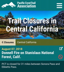
I crest a ridge where a bright white rock formation glows beside the trail. From here, I can see smoke rising from the Donnell Fire. I catch myself wondering if the trail really is open, after all. But of course it is. I checked and double-checked and tripled-checked the websites. Also, there were no signs at the trailhead. I’m safe.
Smoke plume from Donnell Fire.
I cut across the slope on a pretty traverse and stop for lunch 14 miles into the day. I’m doing better than I expected: I don’t feel sick like I did the last few days, I’m moving at a quick pace, and I’m not even really feeling the altitude. I’m cold, though. Sitting for lunch, my temperature drops. I pull on more layers against the wind.
After lunch, I climb and descend repeatedly. The views of the surrounding mountains are wonderful. At the top of one climb, I get another view of wildfire smoke. Eventually I hit a steeeep descent. It’s steep enough that I bust out my trekking poles. I’m not looking forward to climbing this tomorrow on the return trip to my car.
When the trail switches back, I see where it’s going to take me: up up up through forest to the ridge that runs southeast of Sonora Peak, where I turned back last year. It will be a long climb.
The route ahead.
As the steep descent levels out, I encounter another NOBO. He’s finishing up his thru-hike and will finish north of Tahoe. A few minutes later, I come upon another NOBO. Like me, she’s finishing her 2017 hike. Her end point is Donner Summit.
I now begin the climb that will take me to the top of the ridge, a gain of 2,400 feet in six miles. I can’t do all of that tonight. I’m already 22 miles into my day, plus there’s no campsite up there, and even if there was, it would be too windy to even consider – so I plan to walk to the last campsite listed. This will give me a 25-mile day. I’m shocked I’m capable of a 25-mile day after such a long hiatus. Motivation is a powerful force.
Halfway through the climb to my campsite, I encounter three more hikers. They’re hiking northbound, though one is a 2018 SOBO. The other two are finishing their hikes from previous years. We talk for awhile and eventually move along.
More climbing for me. I’m slowing down. I’m not feeling well. When I reach my campsite, I’m sort of in trouble. I quickly pitch my tent, because that’s always the first thing I do, and then I make myself eat dinner. As the food settles, I understand what my problem was: I was too hungry. I didn’t realize how hungry I was. All day I’d fed myself snacks. Apparently that wasn’t enough.
My body calms as it digests. I retreat to my tent and clean up. I write about my day. I burrow into my sleeping bag and think about what’s coming tomorrow. In my tent with all of my things laid out around me, I almost feel like I never left the trail.
In March of this year, I started running. Back at work with long days in the office, I wanted to put miles under my feet, but after work I’d only have enough daylight for short distances. I could go farther running than I could walking, so I ran. I craved the high-mileage days I’d had on the PCT. On the trail, I’d cover 25-30 miles on a good day, 30-35 on a great day. Running, I might be able to do…50? I wanted to know how far I could go. I wanted to push myself.
I ran trails. To avoid injury, I adopted a run-walk strategy. All went well as I slowly added mileage. Then, in mid-June, I ran on pavement and messed up my left posterior tibial tendon. A PTT injury requires rest to avoid permanent damage. Rest. It sounded like a bad word. I’d started running to treat post-thru-hike depression but now, not only could I not run, I couldn’t hike; as summer progressed, I couldn’t tackle any of the missing PCT miles I’d hoped to complete this year. I felt desperate but didn’t dare attempt more than a few short hikes for fear of aggravating my injury and taking myself out for the rest of the year.
By early August, this strategy paid off: I bagged a 10-mile hike and felt ready for more. Greg and I made plans for Labor Day weekend: if my ankle held up, we would hike from Ebbetts Pass to Sonora Pass, finally completing my 2017 PCT thru-hike*. These were the miles I coveted most out of all of the miles I missed last year. Most of those missing miles were due to fire closures. Not Sonora to Ebbetts. I’d been defeated there. This was personal. And this was the finish line for the hike I started more than a year ago.
Just days after Greg and I made our plan, the Donnell Fire broke out, and the PCT promptly closed between Sonora Pass and Ebbetts Pass. I watched the daily updates coming off the Donnell Fire. As the fire spread toward the PCT, my heart sank. I wouldn’t be able to complete my thru-hike over Labor Day weekend after all, and perhaps not until next summer.
At least my injury had healed. I walked an official marathon. During and after, my ankle felt fine. A co-worker and I got out of the office for a survey that involved a few miles of cross-country hiking through the forest. All went well…until we came upon human remains at the end of a dead-end road.
We thought we’d stumbled upon a murder victim. We quickly left the area and reported what we’d found. I got little sleep that night. The next day, we learned that we’d located a woman from out of the area who’d been reported missing a month earlier. Later, we learned that foul play was not suspected in her death. However, her tragic circumstances haunted me. I went about in a daze. I sought counseling to help me deal with what I’d seen. I wondered what stroke of bad luck was going to hit next, and how bad it was going to be.
One day in mid-September, I performed my daily ritual of checking in on the Donnell Fire. Surprise! The PCT was open! The Donnell Fire still burned, but the threat to the trail had passed. At the end of the week, I drove straight to Ebbetts Pass. I wasn’t going to let a single weekend go by without attempting this hike.
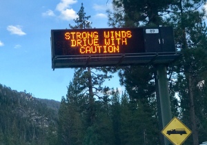
The forecast predicted sun and high winds – just like last year. At least I knew what to expect. As I drove closer to my destination, a sign along the highway confirmed that high winds were already underway. I arrived at the trailhead after dark and spent the night in my car.
My itinerary: Ebbetts Pass south to mile 1020, then back to Ebbetts for total distance of 56 miles. When I hit the turn-around at mile 1020, I will complete my PCT thru-hike*.
*I define “completing my thru-hike” as completing all of the miles that were open to me in 2017, the year I hiked.
I’ve completed my first official marathon, one not measured by miles delineated on a trail app. This was an actual race, a Boston-qualifier, even – but I didn’t attempt to qualify. I walked the entire distance.
I registered for the race months ago, intending to run. Then, an ankle injury kept me from running during the nine weeks leading up to the race. When race day came, I opted to walk rather than risk further injury.
Walking backpack-free for 26+ miles on a mostly-flat course would be a novel experience. I didn’t know how fast I could walk, or how long I could maintain my fastest pace. I’d never walked 26 miles without at least a few sit-down stops along the way. I hoped to complete the marathon in 7 hours.
I took the early start option, lining up at the starting line at 5:30am. It was light enough to see without assistance from my headlamp, but only just. I wore my hiking clothes, hiking shoes, and hydration vest. My race number was pinned to the front of my shirt.
I left the starting line with a pace hovering around 14:30/mile, quick but comfortable, a notch below my top speed. I didn’t want to push too hard too fast and flame out in the final miles. The distance wouldn’t be a challenge, but maintaining top speed over such a distance might be.
Aid stations appeared like trail magic. At the first station, I ducked into an outhouse, then resupplied with a cup of electrolytes and a sleeve of energy gels. The volunteers seemed surprised that I intended to walk the entire marathon. They enthusiastically cheered me on.
Near mile 8, my husband joined me on his bicycle. In the bike’s panniers, he carried four liters of water, two bags of potato chips, four energy bars, a change of socks, my sunglasses, and my silver sun umbrella.
I munched potato chips while I walked. At mile 14.5, I sat to change into dry socks. My average pace tumbled as a result of this break, so for the next mile I pushed myself hard to make up time. My husband refilled my water bottles, then left me to walk alone for the next five or so miles.
In mile 18, I spent a few minutes in another outhouse. Again my pace dropped, and again I pushed myself to make up lost time.
Until now, I’d maintained an average pace of approximately 14:30/mile, including the sock change and outhouse breaks. I’d had to work for this pace, but I wasn’t in danger of wearing myself out. Now I allowed myself to walk as fast as I could. As the miles ticked by, my pace hovered below 13:30/mile.
By now the sun was high, the temperature climbing. The last five miles of the course wound through long shade-less stretches. I retrieved my silver umbrella from the bicycle panniers and cruised down the road beneath it.
One after another, I overtook runners who’d slowed to walk, or walk-jog. They looked uncomfortable, or worse. I felt guilty for breezing by, feeling fantastic. And I was thrilled to feel so fantastic. I was at my limit – I couldn’t walk any faster – but mile after mile I maintained this speed, and doing so wasn’t difficult. Should I have let loose earlier? At mile 15, maybe? At mile 10?
I crossed the finish line in 6 hours 21 minutes – obliterating my previous speed record for that distance – and earned my first marathon finisher’s medal.
Thank you to the organizers of Running with the Bears for a fantastic event, and thank you to my husband Greg for serving as my support crew during this endeavor.
The first two weekends in April arrive with winter storm warnings, so we wait for a storm-free weekend to complete our 40th consecutive month of backpacking. When Earth Day weekend promises sunny weather, we make plans to snow camp along the Tahoe Rim Trail. Then, we both catch a cold.
For me, the symptoms are minor. After fighting off the worst flu of my life in January 2013, I rarely get sick; when I do, I develop mild, fleeting versions of the usual symptoms associated with colds and flus. This might sound like a blessing, but I’d much rather have the full effect: fever, congestion, and cough would be welcome signs that I’m not having a Lyme relapse. I’d rather spend a week knocked out by a cold than spend months cycling through Lyme disease.
Because the symptoms I experience when I’m fighting a cold mimic the symptoms I had during Lyme flares, I’m never certain if I’m actually sick, or if I need to drag myself back to my doctor for an evaluation and, possibly, more antibiotics. This time, however, one of my co-workers comes down with symptoms identical to mine – right down to having to run for the toilet. Hurray! I must be sick!
The day after I start feeling sick, Greg starts feeling horrible, so we revise our April backpacking plans. Instead of a long day of snow-shoeing the Rim Trail, we’ll take the PCT north from Highway 49.
Early on Saturday afternoon we begin hiking. The climb is continuous but well-graded. After the first two miles, we find snow across the trail. The snow patches grow and deepen as we climb. We pass a few day hikers coming down.
After 3.5 miles and 1,500 feet of elevation gain, the trail reaches a saddle under the Sierra Buttes with spectacular views into the North Yuba River Canyon. We’ve reached our destination.
On this trip, we each have our own tent. One reason: I don’t want to share a tent with someone who will be coughing and blowing his nose all night. Another reason: Greg wants to test drive the tent he’s making, a roomy one-person cuben-fiber shelter still under construction but nearing completion. Nostalgia hits when I pitch my little Copper Spur tent for the first time since finishing my thru-hike in October.
We eat dinner. Greg goes to bed early. I stay up to watch the sun set. The Sierra Buttes cast a dramatic shadow on the opposite wall of the canyon. The shadow creeps upward as the sun sinks.
In the morning, Fox Sparrows are up and singing before I emerge from my tent. Greg and I have breakfast, then pack up and begin the descent. It’s a quick, easy hike down to the trailhead. Soon, we’ve completed our 40th month.
(In January 2015, Greg and I began backpacking at least once per month, year-round. April 2018 is our 40th consecutive month with at least one backpacking trip.)